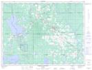
Maps showing Lac Gauthier, Cochrane, Ontario
Lac Gauthier is a Lake located in Cochrane, Ontario.
- Latitude: 48° 34' 18'' North (decimal: 48.5716666)
- Longitude: 80° 38' 31'' West (decimal: -80.6419444)
- Topography Feature Category: Lake
- Geographical Feature: Lac
- Canadian Province/Territory: Ontario
- Location: Cochrane
- Atlas of Canada Locator Map: Lac Gauthier
- GPS Coordinate Locator Map: Lac Gauthier Lat/Long
Lac Gauthier NTS Map Sheets