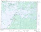
Maps showing Saug-A-Gaw-Sing 1, Rainy River, Ontario
Saug-A-Gaw-Sing 1 is a Indian Reserve located in Rainy River, Ontario.
- Latitude: 49° 7' 45'' North (decimal: 49.1291666)
- Longitude: 94° 18' 34'' West (decimal: -94.3094443)
- Topography Feature Category: Indian Reserve
- Geographical Feature: Indian Reserve - Réserve indienne
- Canadian Province/Territory: Ontario
- Location: Rainy River
- Atlas of Canada Locator Map: Saug-A-Gaw-Sing 1
- GPS Coordinate Locator Map: Saug-A-Gaw-Sing 1 Lat/Long