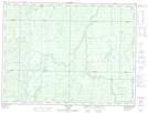
Maps showing Flying Post 73, Cochrane, Ontario
Flying Post 73 is a Indian Reserve located in Cochrane, Ontario.
- Latitude: 48° 32' 00'' North (decimal: 48.5333333)
- Longitude: 82° 1' 5'' West (decimal: -82.0180555)
- Topography Feature Category: Indian Reserve
- Geographical Feature: Indian Reserve - Réserve indienne
- Canadian Province/Territory: Ontario
- Location: Cochrane
- Atlas of Canada Locator Map: Flying Post 73
- GPS Coordinate Locator Map: Flying Post 73 Lat/Long