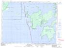
Maps showing Lake of the Woods 31H, Kenora, Ontario
Lake of the Woods 31H is a Indian Reserve located in Kenora, Ontario.
- Latitude: 49° 6' 50'' North (decimal: 49.1138888)
- Longitude: 94° 43' 23'' West (decimal: -94.7230555)
- Topography Feature Category: Indian Reserve
- Geographical Feature: Indian Reserve - Réserve indienne
- Canadian Province/Territory: Ontario
- Location: Kenora
- Atlas of Canada Locator Map: Lake of the Woods 31H
- GPS Coordinate Locator Map: Lake of the Woods 31H Lat/Long