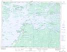
Maps showing Lake of the Woods 35J, Kenora, Ontario
Lake of the Woods 35J is a Indian Reserve located in Kenora, Ontario.
- Latitude: 49° 12' 33'' North (decimal: 49.2091666)
- Longitude: 94° 22' 3'' West (decimal: -94.3674998)
- Topography Feature Category: Indian Reserve
- Geographical Feature: Indian Reserve - Réserve indienne
- Canadian Province/Territory: Ontario
- Location: Kenora
- Atlas of Canada Locator Map: Lake of the Woods 35J
- GPS Coordinate Locator Map: Lake of the Woods 35J Lat/Long