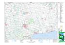
Maps showing New Credit 40A, Brant*, Ontario
New Credit 40A is a Indian Reserve located in Brant*, Ontario.
- Latitude: 42° 59' 58'' North (decimal: 42.9994443)
- Longitude: 80° 5' 44'' West (decimal: -80.0955555)
- Topography Feature Category: Indian Reserve
- Geographical Feature: Indian Reserve - Réserve indienne
- Canadian Province/Territory: Ontario
- Location: Brant*
- Atlas of Canada Locator Map: New Credit 40A
- GPS Coordinate Locator Map: New Credit 40A Lat/Long