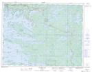
Maps showing Yellow Girl Bay 32B, Kenora, Ontario
Yellow Girl Bay 32B is a Indian Reserve located in Kenora, Ontario.
- Latitude: 49° 30' 1'' North (decimal: 49.5002778)
- Longitude: 94° 11' 50'' West (decimal: -94.1972221)
- Topography Feature Category: Indian Reserve
- Geographical Feature: Indian Reserve - Réserve indienne
- Canadian Province/Territory: Ontario
- Location: Kenora
- Atlas of Canada Locator Map: Yellow Girl Bay 32B
- GPS Coordinate Locator Map: Yellow Girl Bay 32B Lat/Long
Yellow Girl Bay 32B NTS Map Sheets