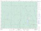
Maps showing Coad Hill, Undersea Features
Coad Hill is a Mountain located in Undersea Features.
- Latitude: 45° 39' 30'' North (decimal: 45.6583333)
- Longitude: 81° 38' 5'' West (decimal: -81.6347221)
- Topography Feature Category: Mountain
- Geographical Feature: Hill
- Canadian Province/Territory: Undersea Features
- Atlas of Canada Locator Map: Coad Hill
- GPS Coordinate Locator Map: Coad Hill Lat/Long
Coad Hill NTS Map Sheets