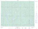
Maps showing Chesterfield Lakes, Ontario
Chesterfield Lakes is a Lake located in Ontario.
- Latitude: 48° 11' 40'' North (decimal: 48.1943999)
- Longitude: 81° 28' 40'' West (decimal: -81.4778000)
- Topography Feature Category: Lake
- Geographical Feature: Lakes
- Canadian Province/Territory: Ontario
- GPS Coordinate Locator Map: Chesterfield Lakes Lat/Long
Chesterfield Lakes NTS Map Sheets