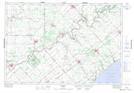
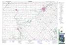
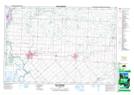
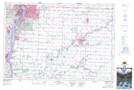
Maps showing Dawn-Euphemia, Lambton; Kent, Ontario
Dawn-Euphemia is a Other municipal/district area - miscellaneous located in Lambton; Kent, Ontario.
- Latitude: 42° 42' 28'' North (decimal: 42.7077777)
- Longitude: 82° 3' 46'' West (decimal: -82.0627777)
- Topography Feature Category: Other municipal/district area - miscellaneous
- Geographical Feature: Township Municipality
- Canadian Province/Territory: Ontario
- Location: Lambton; Kent
- Atlas of Canada Locator Map: Dawn-Euphemia
- GPS Coordinate Locator Map: Dawn-Euphemia Lat/Long
Dawn-Euphemia NTS Map Sheets