Maps showing Tikamaganda Lake Conservation Reserve, Algoma, Ontario
Tikamaganda Lake Conservation Reserve is a Conservation area located in Algoma, Ontario.
- Latitude: 47° 33' 30'' North (decimal: 47.5582999)
- Longitude: 84° 10' 50'' West (decimal: -84.1805999)
- Topography Feature Category: Conservation area
- Geographical Feature: Conservation Reserve
- Canadian Province/Territory: Ontario
- Location: Algoma
- Atlas of Canada Locator Map: Tikamaganda Lake Conservation Reserve
- GPS Coordinate Locator Map: Tikamaganda Lake Conservation Reserve Lat/Long
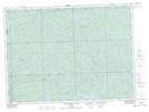
Tikamaganda Lake Conservation Reserve NTS Map Sheets