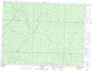
Maps showing Pichogen River Mixed Forest Provincial Park, Walls, Ontario
Pichogen River Mixed Forest Provincial Park is a Conservation area located in Walls, Ontario.
- Latitude: 48° 56' 10'' North (decimal: 48.936206)
- Longitude: 83° 59' 16'' West (decimal: -83.987821)
- Topography Feature Category: Conservation area
- Geographical Feature: Provincial Nature Reserve
- Canadian Province/Territory: Ontario
- Location: Walls
- Atlas of Canada Locator Map: Pichogen River Mixed Forest Provincial Park
- GPS Coordinate Locator Map: Pichogen River Mixed Forest Provincial Park Lat/Long