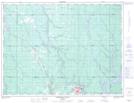
Maps showing Nahma Bog and Poor Fens Conservation Reserve, St John, Ontario
Nahma Bog and Poor Fens Conservation Reserve is a Conservation area located in St John, Ontario.
- Latitude: 48° 58' 9'' North (decimal: 48.96921)
- Longitude: 80° 54' 31'' West (decimal: -80.908473)
- Topography Feature Category: Conservation area
- Geographical Feature: Conservation Reserve
- Canadian Province/Territory: Ontario
- Location: St John
- Atlas of Canada Locator Map: Nahma Bog and Poor Fens Conservation Reserve
- GPS Coordinate Locator Map: Nahma Bog and Poor Fens Conservation Reserve Lat/Long
Nahma Bog and Poor Fens Conservation Reserve NTS Map Sheets