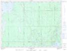
Maps showing Night Hawk Lake Shoreline Bluffs Conservation Reserve, Macklem, Ontario
Night Hawk Lake Shoreline Bluffs Conservation Reserve is a Conservation area located in Macklem, Ontario.
- Latitude: 48° 28' 6'' North (decimal: 48.468212)
- Longitude: 80° 52' 20'' West (decimal: -80.872128)
- Topography Feature Category: Conservation area
- Geographical Feature: Conservation Reserve
- Canadian Province/Territory: Ontario
- Location: Macklem
- Atlas of Canada Locator Map: Night Hawk Lake Shoreline Bluffs Conservation Reserve
- GPS Coordinate Locator Map: Night Hawk Lake Shoreline Bluffs Conservation Reserve Lat/Long
Night Hawk Lake Shoreline Bluffs Conservation Reserve NTS Map Sheets