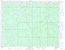
Maps showing North Muskego River Mixed Forest Conservation Reserve, Kirkland, Ontario
North Muskego River Mixed Forest Conservation Reserve is a Conservation area located in Kirkland, Ontario.
- Latitude: 48° 57' 36'' North (decimal: 48.960081)
- Longitude: 81° 48' 5'' West (decimal: -81.801452)
- Topography Feature Category: Conservation area
- Geographical Feature: Conservation Reserve
- Canadian Province/Territory: Ontario
- Location: Kirkland
- Atlas of Canada Locator Map: North Muskego River Mixed Forest Conservation Reserve
- GPS Coordinate Locator Map: North Muskego River Mixed Forest Conservation Reserve Lat/Long
North Muskego River Mixed Forest Conservation Reserve NTS Map Sheets