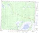
Maps showing Plummers Marsh, 49-25,26-W;50-25,26-W, Manitoba
Plummers Marsh is a Low vegetation located in 49-25,26-W;50-25,26-W, Manitoba.
- Latitude: 53° 16' 22'' North (decimal: 53.2728000)
- Longitude: 101° 7' 23'' West (decimal: -101.1231000)
- Topography Feature Category: Low vegetation
- Geographical Feature: Marsh
- Canadian Province/Territory: Manitoba
- Location: 49-25,26-W;50-25,26-W
- Atlas of Canada Locator Map: Plummers Marsh
- GPS Coordinate Locator Map: Plummers Marsh Lat/Long