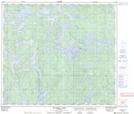
Maps showing Anikwuchas Lake, 22-81-13-W, Manitoba
Anikwuchas Lake is a Lake located in 22-81-13-W, Manitoba and has an elevation of 273 meters.
- Latitude: 56° 1' 57'' North (decimal: 56.0324999)
- Longitude: 99° 25' 5'' West (decimal: -99.4181000)
- Topography Feature Category: Lake
- Geographical Feature: Lake
- Canadian Province/Territory: Manitoba
- Elevation: 273 meters
- Location: 22-81-13-W
- Atlas of Canada Locator Map: Anikwuchas Lake
- GPS Coordinate Locator Map: Anikwuchas Lake Lat/Long
Anikwuchas Lake NTS Map Sheets