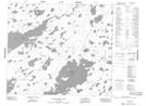
Maps showing Apakisthemosi Rapids, Manitoba
Apakisthemosi Rapids is a Rapids located in Manitoba and has an elevation of 172 meters.
- Latitude: 55° 13' 49'' North (decimal: 55.2303000)
- Longitude: 94° 11' 14'' West (decimal: -94.1872000)
- Topography Feature Category: Rapids
- Geographical Feature: Rapids
- Canadian Province/Territory: Manitoba
- Elevation: 172 meters
- Atlas of Canada Locator Map: Apakisthemosi Rapids
- GPS Coordinate Locator Map: Apakisthemosi Rapids Lat/Long
Apakisthemosi Rapids NTS Map Sheets