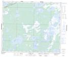
Maps showing Atikameg Lake, 3-58-24-W, Manitoba
Atikameg Lake is a Unincorporated area located in 3-58-24-W, Manitoba and has an elevation of 267 meters.
- Latitude: 53° 59' 14'' North (decimal: 53.9872000)
- Longitude: 100° 56' 5'' West (decimal: -100.9346999)
- Topography Feature Category: Unincorporated area
- Geographical Feature: Railway Point
- Canadian Province/Territory: Manitoba
- Elevation: 267 meters
- Location: 3-58-24-W
- Atlas of Canada Locator Map: Atikameg Lake
- GPS Coordinate Locator Map: Atikameg Lake Lat/Long
Atikameg Lake NTS Map Sheets