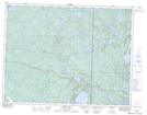
Maps showing Bert Island, 3,10-11-17-E, Manitoba
Bert Island is a Island located in 3,10-11-17-E, Manitoba and has an elevation of 362 meters.
- Latitude: 49° 54' 6'' North (decimal: 49.9016999)
- Longitude: 95° 11' 17'' West (decimal: -95.1881000)
- Topography Feature Category: Island
- Geographical Feature: Island
- Canadian Province/Territory: Manitoba
- Elevation: 362 meters
- Location: 3,10-11-17-E
- Atlas of Canada Locator Map: Bert Island
- GPS Coordinate Locator Map: Bert Island Lat/Long