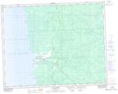
Maps showing Big Falls, 4-22-9-E, Manitoba
Big Falls is a Falls located in 4-22-9-E, Manitoba and has an elevation of 222 meters.
- Latitude: 50° 50' 46'' North (decimal: 50.8460999)
- Longitude: 96° 17' 56'' West (decimal: -96.2988999)
- Topography Feature Category: Falls
- Geographical Feature: Falls
- Canadian Province/Territory: Manitoba
- Elevation: 222 meters
- Location: 4-22-9-E
- Atlas of Canada Locator Map: Big Falls
- GPS Coordinate Locator Map: Big Falls Lat/Long
Big Falls NTS Map Sheets