Canada Topographic Maps

Big Sand Lake Topo Maps

Topography maps and Latitude/Longitude Location

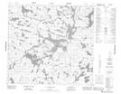
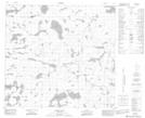
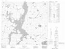
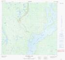
Maps showing Big Sand Lake, Manitoba

Big Sand Lake is a Lake located in Manitoba and has an elevation of 313 meters.

  • Latitude: 57° 44' 58'' North   (decimal: 57.7493999)
  • Longitude: 99° 44' 37'' West   (decimal: -99.7436000)
  • Topography Feature Category: Lake
  • Geographical Feature: Lake
  • Canadian Province/Territory: Manitoba
  • Elevation: 313 meters
  • Atlas of Canada Locator Map: Big Sand Lake
  • GPS Coordinate Locator Map: Big Sand Lake Lat/Long

Big Sand Lake NTS Map Sheets

064F08 Le Clair Lake Topographic Map at 1:50,000 scale

064G05 James Lake Topographic Map at 1:50,000 scale

064G12 Hendry Lake Topographic Map at 1:50,000 scale

064G13 Maxwell Lake Topographic Map at 1:50,000 scale

064G14 Wolf Lake Topographic Map at 1:50,000 scale

064F Brochet Topographic Map at 1:250,000 scale

064G Big Sand Lake Topographic Map at 1:250,000 scale

 
Buy Topographic Maps DVD
Newsletter Sign-up

Yes, I want to receive map store discounts.


Bookmark and Share