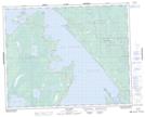
Maps showing Bills Lake, 9,10-31-5-E, Manitoba
Bills Lake is a Lake located in 9,10-31-5-E, Manitoba and has an elevation of 220 meters.
- Latitude: 51° 38' 31'' North (decimal: 51.6419000)
- Longitude: 96° 49' 23'' West (decimal: -96.8231000)
- Topography Feature Category: Lake
- Geographical Feature: Lake
- Canadian Province/Territory: Manitoba
- Elevation: 220 meters
- Location: 9,10-31-5-E
- Atlas of Canada Locator Map: Bills Lake
- GPS Coordinate Locator Map: Bills Lake Lat/Long