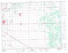
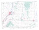
Maps showing Birds Hill Provincial Park, Manitoba
Birds Hill Provincial Park is a Conservation area located in Manitoba and has an elevation of 249 meters.
- Latitude: 50° 1' 28'' North (decimal: 50.0244000)
- Longitude: 96° 53' 1'' West (decimal: -96.8836000)
- Topography Feature Category: Conservation area
- Geographical Feature: Provincial Natural Park
- Canadian Province/Territory: Manitoba
- Elevation: 249 meters
- Atlas of Canada Locator Map: Birds Hill Provincial Park
- GPS Coordinate Locator Map: Birds Hill Provincial Park Lat/Long
Birds Hill Provincial Park NTS Map Sheets