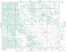
Maps showing Blind Creek, 25-24-3-W, Manitoba
Blind Creek is a River located in 25-24-3-W, Manitoba and has an elevation of 264 meters.
- Latitude: 51° 6' 19'' North (decimal: 51.1053000)
- Longitude: 97° 45' 46'' West (decimal: -97.7628000)
- Topography Feature Category: River
- Geographical Feature: Creek
- Canadian Province/Territory: Manitoba
- Elevation: 264 meters
- Location: 25-24-3-W
- Atlas of Canada Locator Map: Blind Creek
- GPS Coordinate Locator Map: Blind Creek Lat/Long