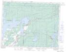
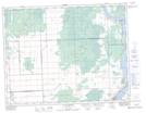
Maps showing Lac du Bonnet, Manitoba
Lac du Bonnet is a Lake located in Manitoba and has an elevation of 251 meters.
- Latitude: 50° 22' 27'' North (decimal: 50.3742000)
- Longitude: 95° 53' 48'' West (decimal: -95.8967000)
- Topography Feature Category: Lake
- Geographical Feature: Lake
- Canadian Province/Territory: Manitoba
- Elevation: 251 meters
- Atlas of Canada Locator Map: Lac du Bonnet
- GPS Coordinate Locator Map: Lac du Bonnet Lat/Long
Lac du Bonnet NTS Map Sheets