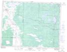
Maps showing Brereton Lake, 11-14,15-E, Manitoba
Brereton Lake is a Lake located in 11-14,15-E, Manitoba and has an elevation of 318 meters.
- Latitude: 49° 54' 16'' North (decimal: 49.9044000)
- Longitude: 95° 32' 40'' West (decimal: -95.5443999)
- Topography Feature Category: Lake
- Geographical Feature: Lake
- Canadian Province/Territory: Manitoba
- Elevation: 318 meters
- Location: 11-14,15-E
- Atlas of Canada Locator Map: Brereton Lake
- GPS Coordinate Locator Map: Brereton Lake Lat/Long