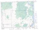
Maps showing Brightstone Sand Hills, 16-9,10-E, Manitoba
Brightstone Sand Hills is a Mountain located in 16-9,10-E, Manitoba and has an elevation of 301 meters.
- Latitude: 50° 22' 15'' North (decimal: 50.3707999)
- Longitude: 96° 12' 18'' West (decimal: -96.2049999)
- Topography Feature Category: Mountain
- Geographical Feature: Sand Hills
- Canadian Province/Territory: Manitoba
- Elevation: 301 meters
- Location: 16-9,10-E
- Atlas of Canada Locator Map: Brightstone Sand Hills
- GPS Coordinate Locator Map: Brightstone Sand Hills Lat/Long
Brightstone Sand Hills NTS Map Sheets