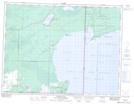
Maps showing Buffalo Point, Manitoba
Buffalo Point is a Cape located in Manitoba and has an elevation of 329 meters.
- Latitude: 49° 0' 2'' North (decimal: 49.0005999)
- Longitude: 95° 14' 00'' West (decimal: -95.2332999)
- Topography Feature Category: Cape
- Geographical Feature: Point
- Canadian Province/Territory: Manitoba
- Elevation: 329 meters
- Atlas of Canada Locator Map: Buffalo Point
- GPS Coordinate Locator Map: Buffalo Point Lat/Long