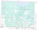
Maps showing Butcher Hill, 2-12-E, Manitoba
Butcher Hill is a Mountain located in 2-12-E, Manitoba and has an elevation of 363 meters.
- Latitude: 49° 6' 15'' North (decimal: 49.1042000)
- Longitude: 95° 53' 26'' West (decimal: -95.8905999)
- Topography Feature Category: Mountain
- Geographical Feature: Hill
- Canadian Province/Territory: Manitoba
- Elevation: 363 meters
- Location: 2-12-E
- Atlas of Canada Locator Map: Butcher Hill
- GPS Coordinate Locator Map: Butcher Hill Lat/Long