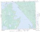
Maps showing Caterpillar Creek, 34-30-5-E, Manitoba
Caterpillar Creek is a River located in 34-30-5-E, Manitoba and has an elevation of 220 meters.
- Latitude: 51° 36' 44'' North (decimal: 51.6122000)
- Longitude: 96° 48' 59'' West (decimal: -96.8163999)
- Topography Feature Category: River
- Geographical Feature: Creek
- Canadian Province/Territory: Manitoba
- Elevation: 220 meters
- Location: 34-30-5-E
- Atlas of Canada Locator Map: Caterpillar Creek
- GPS Coordinate Locator Map: Caterpillar Creek Lat/Long