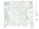
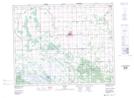
Maps showing Chatfield Lake, Manitoba
Chatfield Lake is a Lake located in Manitoba.
- Latitude: 50° 45' 0'' North (decimal: 50.7500000)
- Longitude: 97° 23' 48'' West (decimal: -97.3967000)
- Topography Feature Category: Lake
- Geographical Feature: Lake
- Canadian Province/Territory: Manitoba
- GPS Coordinate Locator Map: Chatfield Lake Lat/Long
Chatfield Lake NTS Map Sheets