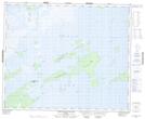
Maps showing Chemahawin Point, Manitoba
Chemahawin Point is a Cape located in Manitoba.
- Latitude: 53° 18' 52'' North (decimal: 53.3143999)
- Longitude: 100° 22' 49'' West (decimal: -100.3803000)
- Topography Feature Category: Cape
- Geographical Feature: Point
- Canadian Province/Territory: Manitoba
- GPS Coordinate Locator Map: Chemahawin Point Lat/Long
Chemahawin Point NTS Map Sheets