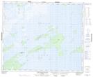
Maps showing Chemawawin Island, 50-20-W, Manitoba
Chemawawin Island is a Island located in 50-20-W, Manitoba and has an elevation of 253 meters.
- Latitude: 53° 18' 52'' North (decimal: 53.3143999)
- Longitude: 100° 22' 49'' West (decimal: -100.3803000)
- Topography Feature Category: Island
- Geographical Feature: Island
- Canadian Province/Territory: Manitoba
- Elevation: 253 meters
- Location: 50-20-W
- Atlas of Canada Locator Map: Chemawawin Island
- GPS Coordinate Locator Map: Chemawawin Island Lat/Long
Chemawawin Island NTS Map Sheets