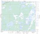
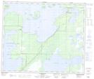
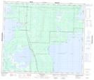
Maps showing Clearwater Lake Provincial Park, Manitoba
Clearwater Lake Provincial Park is a Conservation area located in Manitoba and has an elevation of 270 meters.
- Latitude: 54° 4' 59'' North (decimal: 54.0831000)
- Longitude: 101° 4' 42'' West (decimal: -101.0783000)
- Topography Feature Category: Conservation area
- Geographical Feature: Provincial Natural Park
- Canadian Province/Territory: Manitoba
- Elevation: 270 meters
- Atlas of Canada Locator Map: Clearwater Lake Provincial Park
- GPS Coordinate Locator Map: Clearwater Lake Provincial Park Lat/Long
Clearwater Lake Provincial Park NTS Map Sheets