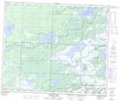
Maps showing Cooks Creek, Manitoba
Cooks Creek is a River located in Manitoba.
- Latitude: 53° 53' 3'' North (decimal: 53.8842000)
- Longitude: 101° 32' 18'' West (decimal: -101.5382999)
- Topography Feature Category: River
- Geographical Feature: Creek
- Canadian Province/Territory: Manitoba
- Atlas of Canada Locator Map: Cooks Creek
- GPS Coordinate Locator Map: Cooks Creek Lat/Long
Cooks Creek NTS Map Sheets