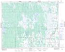
Maps showing Cruiser Lake, 3-28-4-W, Manitoba
Cruiser Lake is a Lake located in 3-28-4-W, Manitoba and has an elevation of 262 meters.
- Latitude: 51° 22' 18'' North (decimal: 51.3716999)
- Longitude: 97° 56' 33'' West (decimal: -97.9425000)
- Topography Feature Category: Lake
- Geographical Feature: Lake
- Canadian Province/Territory: Manitoba
- Elevation: 262 meters
- Location: 3-28-4-W
- Atlas of Canada Locator Map: Cruiser Lake
- GPS Coordinate Locator Map: Cruiser Lake Lat/Long