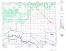
Maps showing Deep Creek Drain, Manitoba
Deep Creek Drain is a Hydraulic construction located in Manitoba and has an elevation of 245 meters.
- Latitude: 50° 3' 38'' North (decimal: 50.0606000)
- Longitude: 97° 51' 57'' West (decimal: -97.8658000)
- Topography Feature Category: Hydraulic construction
- Geographical Feature: Drain
- Canadian Province/Territory: Manitoba
- Elevation: 245 meters
- Atlas of Canada Locator Map: Deep Creek Drain
- GPS Coordinate Locator Map: Deep Creek Drain Lat/Long