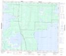
Maps showing Dinner Place Creek, 58-27-W, Manitoba
Dinner Place Creek is a River located in 58-27-W, Manitoba and has an elevation of 273 meters.
- Latitude: 53° 59' 38'' North (decimal: 53.9939000)
- Longitude: 101° 24' 13'' West (decimal: -101.4036000)
- Topography Feature Category: River
- Geographical Feature: Creek
- Canadian Province/Territory: Manitoba
- Elevation: 273 meters
- Location: 58-27-W
- Atlas of Canada Locator Map: Dinner Place Creek
- GPS Coordinate Locator Map: Dinner Place Creek Lat/Long
Dinner Place Creek NTS Map Sheets