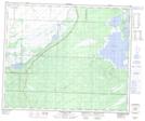
Maps showing Doyle Creek, 30-53-27-W1, Manitoba
Doyle Creek is a River located in 30-53-27-W1, Manitoba.
- Latitude: 53° 36' 0'' North (decimal: 53.6000000)
- Longitude: 101° 25' 44'' West (decimal: -101.4289000)
- Topography Feature Category: River
- Geographical Feature: Creek
- Canadian Province/Territory: Manitoba
- Location: 30-53-27-W1
- GPS Coordinate Locator Map: Doyle Creek Lat/Long
Doyle Creek NTS Map Sheets