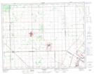
Maps showing East Branch Grassmere Creek Drain, 3-13-1-E, Manitoba
East Branch Grassmere Creek Drain is a River located in 3-13-1-E, Manitoba and has an elevation of 248 meters.
- Latitude: 50° 4' 8'' North (decimal: 50.0689000)
- Longitude: 97° 22' 47'' West (decimal: -97.3796999)
- Topography Feature Category: River
- Geographical Feature: Branch
- Canadian Province/Territory: Manitoba
- Elevation: 248 meters
- Location: 3-13-1-E
- Atlas of Canada Locator Map: East Branch Grassmere Creek Drain
- GPS Coordinate Locator Map: East Branch Grassmere Creek Drain Lat/Long