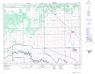
Maps showing East Branch Sturgeon Creek, Manitoba
East Branch Sturgeon Creek is a River located in Manitoba and has an elevation of 250 meters.
- Latitude: 50° 3' 31'' North (decimal: 50.0585999)
- Longitude: 97° 33' 42'' West (decimal: -97.5617000)
- Topography Feature Category: River
- Geographical Feature: Branch
- Canadian Province/Territory: Manitoba
- Elevation: 250 meters
- Atlas of Canada Locator Map: East Branch Sturgeon Creek
- GPS Coordinate Locator Map: East Branch Sturgeon Creek Lat/Long