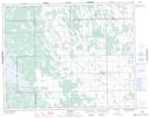
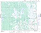
Maps showing East Fisher River, 26-1-W, Manitoba
East Fisher River is a River located in 26-1-W, Manitoba and has an elevation of 237 meters.
- Latitude: 51° 16' 28'' North (decimal: 51.2743999)
- Longitude: 97° 34' 47'' West (decimal: -97.5796999)
- Topography Feature Category: River
- Geographical Feature: River
- Canadian Province/Territory: Manitoba
- Elevation: 237 meters
- Location: 26-1-W
- Atlas of Canada Locator Map: East Fisher River
- GPS Coordinate Locator Map: East Fisher River Lat/Long
East Fisher River NTS Map Sheets