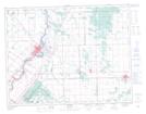
Maps showing East Selkirk Station, Manitoba
East Selkirk Station is a Unincorporated area located in Manitoba and has an elevation of 230 meters.
- Latitude: 50° 7' 39'' North (decimal: 50.1274999)
- Longitude: 96° 49' 0'' West (decimal: -96.8166999)
- Topography Feature Category: Unincorporated area
- Geographical Feature: Locality
- Canadian Province/Territory: Manitoba
- Elevation: 230 meters
- Atlas of Canada Locator Map: East Selkirk Station
- GPS Coordinate Locator Map: East Selkirk Station Lat/Long