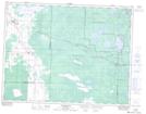
Maps showing Ellis Island, Manitoba
Ellis Island is a Island located in Manitoba and has an elevation of 318 meters.
- Latitude: 49° 53' 23'' North (decimal: 49.8896999)
- Longitude: 95° 32' 50'' West (decimal: -95.5471999)
- Topography Feature Category: Island
- Geographical Feature: Island
- Canadian Province/Territory: Manitoba
- Elevation: 318 meters
- Atlas of Canada Locator Map: Ellis Island
- GPS Coordinate Locator Map: Ellis Island Lat/Long