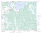
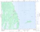
Maps showing Fisher Bay, 7-29-2-E, Manitoba
Fisher Bay is a Unincorporated area located in 7-29-2-E, Manitoba and has an elevation of 219 meters.
- Latitude: 51° 28' 40'' North (decimal: 51.4777999)
- Longitude: 97° 17' 51'' West (decimal: -97.2974999)
- Topography Feature Category: Unincorporated area
- Geographical Feature: Northern Community
- Canadian Province/Territory: Manitoba
- Elevation: 219 meters
- Location: 7-29-2-E
- Atlas of Canada Locator Map: Fisher Bay
- GPS Coordinate Locator Map: Fisher Bay Lat/Long
Fisher Bay NTS Map Sheets