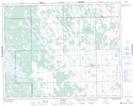
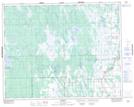
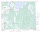
Maps showing Fisher River, 28-1-E, Manitoba
Fisher River is a River located in 28-1-E, Manitoba and has an elevation of 228 meters.
- Latitude: 51° 26' 15'' North (decimal: 51.4375000)
- Longitude: 97° 17' 11'' West (decimal: -97.2864000)
- Topography Feature Category: River
- Geographical Feature: River
- Canadian Province/Territory: Manitoba
- Elevation: 228 meters
- Location: 28-1-E
- Atlas of Canada Locator Map: Fisher River
- GPS Coordinate Locator Map: Fisher River Lat/Long
Fisher River NTS Map Sheets