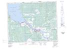
Maps showing Fontaine Point, Manitoba
Fontaine Point is a Cape located in Manitoba and has an elevation of 219 meters.
- Latitude: 50° 36' 5'' North (decimal: 50.6013999)
- Longitude: 96° 17' 16'' West (decimal: -96.2878000)
- Topography Feature Category: Cape
- Geographical Feature: Point
- Canadian Province/Territory: Manitoba
- Elevation: 219 meters
- Atlas of Canada Locator Map: Fontaine Point
- GPS Coordinate Locator Map: Fontaine Point Lat/Long