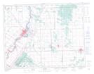
Maps showing Fort Garry, Manitoba
Fort Garry is a Unincorporated area located in Manitoba and has an elevation of 232 meters.
- Latitude: 50° 6' 43'' North (decimal: 50.1118999)
- Longitude: 96° 56' 3'' West (decimal: -96.9342000)
- Topography Feature Category: Unincorporated area
- Geographical Feature: Railway Point
- Canadian Province/Territory: Manitoba
- Elevation: 232 meters
- Atlas of Canada Locator Map: Fort Garry
- GPS Coordinate Locator Map: Fort Garry Lat/Long