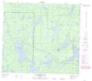
Maps showing Gallagher Lake, Manitoba
Gallagher Lake is a Lake located in Manitoba and has an elevation of 333 meters.
- Latitude: 56° 59' 26'' North (decimal: 56.9905999)
- Longitude: 100° 44' 37'' West (decimal: -100.7435999)
- Topography Feature Category: Lake
- Geographical Feature: Lake
- Canadian Province/Territory: Manitoba
- Elevation: 333 meters
- Atlas of Canada Locator Map: Gallagher Lake
- GPS Coordinate Locator Map: Gallagher Lake Lat/Long
Gallagher Lake NTS Map Sheets